Super Typhoon Goring is expected to exit the Philippine Area of Responsibility (PAR) on Wednesday evening or Thursday morning, according to PAGASA.
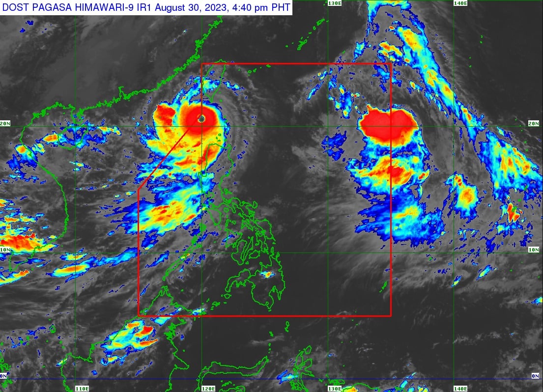
At 4 p.m., Goring was located 185 kilometers west of Itbayat, Batanes, packing maximum sustained winds of 195 kilometers per hour near the center and gustiness of up to 240 km/h.
It was moving west northwestward at 15 km/h.
”Super Typhoon Goring continues to maintain its strength as it approaches the northwestern boundary of the PAR,” the state weather bureau said in its 5 p.m. bulletin.
Signal No. 1 was hoisted over Batanes, the Babuyan Islands, Ilocos Norte, the northern portion of Apayao (Luna, Santa Marcela, and Calanasan), and the northwestern portion of Cagayan (Pamplona, Claveria, Ballesteros, Abulug, Sanchez-Mira, Santa Praxedes).
Meanwhile, the enhanced Southwest Monsoon (Habagat) will bring occasional or monsoon rains over the western portions of Luzon and Visayas over the next three days.
Other tropical cyclones
The state weather bureau is also monitoring two tropical cyclones outside PAR.
At 3 p.m. Severe Tropical Storm Haikui was spotted 1,380 km east of extreme northern Luzon, with maximum sustained winds of 100 km/h and gustiness of up to 125 km/h.
Haikui follows a west northwestward movement at a pace of 15 km/h.
A tropical depression was also located 3,150 km east of Eastern Visayas, with maximum sustained winds of 55 km/h and gustiness of up to 75 km/h. It was traveling northward at 10 km/h.