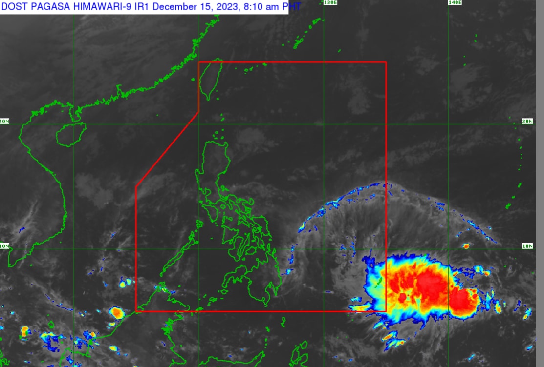
STATE weather forecasters are monitoring a low pressure area outside the Philippine Area of Responsibility (PAR) that could possibly turn into a tropical cyclone and affect Visayas and Mindanao.
PAGASA on Friday morning located the low pressure area 1,595 kilometers east of Southeastern Mindanao.
According to PAGASA weather specialist Obet Badrina, the LPA will enter the PAR on Saturday and bring rains over Visayas and Mindanao starting on Sunday.
Badrina said PAGASA is not ruling out the possibility that the LPA will develop into a tropical cyclone.
Meanwhile, the Ilocos Region, Cordillera Administrative Region, Cagayan Valley, and Central Luzon will experience partly cloudy to cloudy skies with isolated light rains caused by the Northeast Monsoon.
Metro Manila and the rest of the country will have partly cloudy to cloudy skies with isolated rainshowers or thunderstorms due to easterlies and localized thunderstorms.