
READY for Monday?
It seems Caraga and Davao region will get a tough start this week.
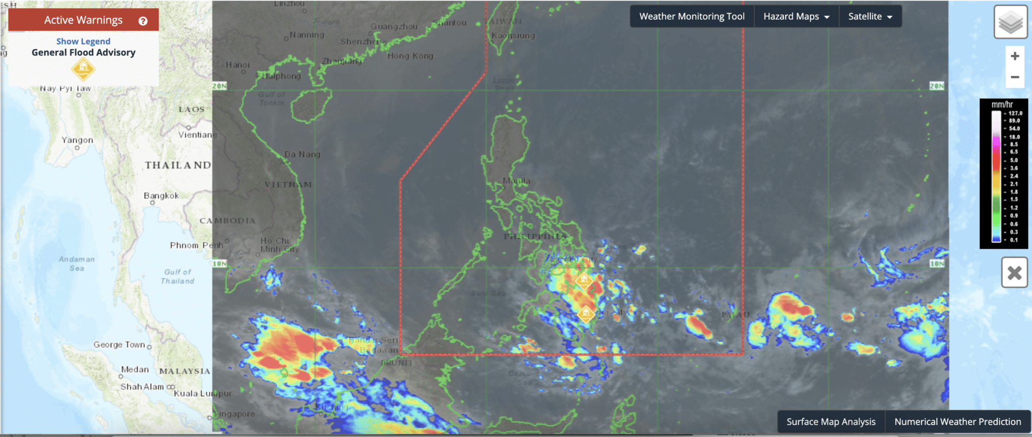
State weather forecasting agency Pagasa issued a general moderate flooding advisory in these two Mindanao regions today, February 13.
Moderate rains with at times heavy rains are pouring over Caraga and Davao regions, Pagasa said.
So if you are living near rivers and tributaries, you should be preparing for possible evacuation as flooding and landslides may occur:
| Province | Rivers and tributaries |
|---|---|
| Agusan Del Sur | Ojot, Wawa, Libang, Maosam, Kasilan, Gibong, Adgaoan, Simulao, Kayonan and Andanan |
| Dinagat Islands | Malinao Inlet and Gaas Lulet |
| Agusan Del Norte | Lake-Mainit-Tubay, Asiga, Agusan, Linugos and Cabadbaran |
| Surigao Del Norte | Surigao and Magallanes |
| Surigao Del Sur | Cantillan, Toracan, Tandag, Tago, Hubo-Oteiza, Hinatuan and Bislig |
| Davao Oriental | Cateel, Dapnan, Baganga Mahan-ub, Manorigao, Caraga, Casaunan, Quinonoan, Bagwan, Mayo, Bitanayan, Sumlog, Tangmoan, Dacongbonwa, Kabasagan, Manay, Maya and Sumlao/Cuabo |
| Davao Del Sur | Davao, Talomo, Lipadas, Tagulaya Sibulan, Digos and Padada Mainit |
| Davao De Oro | Matiao and Hijo |
| Davao Del Norte | Tagum-Libuganon, Tuganay, Saug and Lasang |
| Davao Occidental | Panglan, Malita, Batanan (Lais, Lawan, Latuan, Calian, Lamita, Lawayon, Culama, Caburan Bi, Maubio, Karabana, Tubayo, Kayapung, Malala, Capisolo, Tanoman Bi, Tanoman Smal, Kalbay, Butua, Nuin, Butula, Baki, Malagupo, Balagona, Batulaki |
What’s driving the rains?
There is a low-pressure area east southeast of Mindanao, and its trough or extension have rainclouds flying across Mindanao and Visayas islands.
“Sa eastern section ng Mindanao — Caraga and Davao region — asahan natin na malaki ang tsansa ng pag-ulan ngayong araw dulot ng trough or extension ng low pressure area,” weather specialist Obet Badrina said.
Since 5pm yesterday, February 12, Pagasa has been issuing thunderstorm advisories in the two regions.
Other parts of Mindanao
Most parts of Mindanao will have light to moderate rains. But there will be occasionally heavy rains, too.
Occasional heavy rains as much as 15 liters per square meter per hour woke up residents around 4:30 am today in portions of:
- Lanao del Sur
- Maguindanao del Norte
- Maguindanao del Sur
- Misamis Oriental
- Maguindanao del Sur
- Misamis Oriental
- Sarangani
- South Cotabato
- Sulu
- Zamboanga del Norte
- Davao City
- Bukidnon
- Camiguin
- Misamis Occidental
- North Cotabato
Visayas, Palawan, Mindoro Occidental weather
The trough of the LPA extends to Eastern Visayas and Bohol.
At 5:50 am, Pagasa said moderate to heavy rain showers with lightning and strong winds over Southern Leyte.
As for the whole Visayas, Palawan and Occidental Mindoro will have partly cloudy to cloudy skies with light rains. But this is due to Northeast Monsoon.
Luzon weather
Metro Manila and the rest of Luzon will be generally fair and temperature will mostly be quite colder in the morning.
Except for sporadic light rains, the Northeast Monsoon will have no significant impact over Luzon.
Weather at a glance
| Place | Weather Condition | Caused By | Impacts |
|---|---|---|---|
| Mindanao, Eastern Visayas, and Bohol | Cloudy skies with scattered rainshowers and thunderstorms | Trough of LPA | Possible flash floods or landslides due to light to moderate with at times heavy rains |
| Palawan and the rest of Visayas | Partly cloudy to cloudy skies with isolated rainshowers or thunderstorms | Localized Thunderstorms | Possible flash floods or landslides during severe thunderstorms |
| Metro Manila and the rest of Luzon | Partly cloudy to at times cloudy skies with light rains | Northeast Monsoon | No significant impact |
How useful was this post?
Click on a star to rate it!
Average rating 0 / 5. Vote count: 0
No votes so far! Be the first to rate this post.
We are sorry that this post was not useful for you!
Let us improve this post!
Tell us how we can improve this post?