
TROPICAL Depression “Huaning”, which developed early Monday from a low-pressure area east of Batanes, is not expected to directly affect the Philippines, according to PAGASA.
As of 8:00 AM today, 18 August 2025, Huaning remains inside the Philippine Area of Responsibility (PAR) and continues to move north northwestward at 10 km/h.
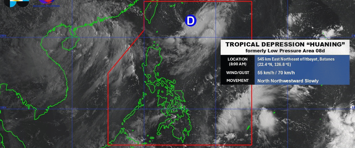
It was last tracked 520 kilometers east northeast of Itbayat, Batanes, with maximum sustained winds of 45 kilometers per hour (km/h) near the center and gustiness of up to 55 km/h.
No tropical cyclone wind signal has been raised in any part of the country. PAGASA said the system is unlikely to directly impact the Philippines within the next 48 hours.
However, moderate seas of up to 2 meters are expected over the seaboards of Batanes, Babuyan Islands, parts of Ilocos Region, Zambales, Bataan, Occidental Mindoro, Lubang Island, and Palawan.
PAGASA advised small vessels, particularly motor canoes, to exercise caution or avoid sailing in these conditions.
The tropical depression is forecast to move generally northward until tonight before turning north northeastward toward Japan’s Ryukyu Islands.
On its current track, Huaning may exit the PAR between late Monday evening and Tuesday morning.
It is expected to remain a tropical depression throughout its passage.
The public is urged to continue monitoring weather updates and advisories from PAGASA.
How useful was this post?
Click on a star to rate it!
Average rating 3 / 5. Vote count: 1
No votes so far! Be the first to rate this post.
We are sorry that this post was not useful for you!
Let us improve this post!
Tell us how we can improve this post?