
STATE weather forecasters raised the Storm Signal No. 1 in at least three areas on Saturday while Tropical Depression Julian traverses the Philippine Sea.
According to PAGASA, the Signal No. 1 was raised at the Cagayan including Babuyan Islands; the northeastern portion of Isabela (San Pablo, Divilacan, Maconacon, Palanan, Cabagan, Santa Maria, Tumauini, Ilagan City, San Mariano, Santo Tomas, Delfin Albano); and the eastern portion of Apayao (Luna, Pudtol, Santa Marcela, Flora).
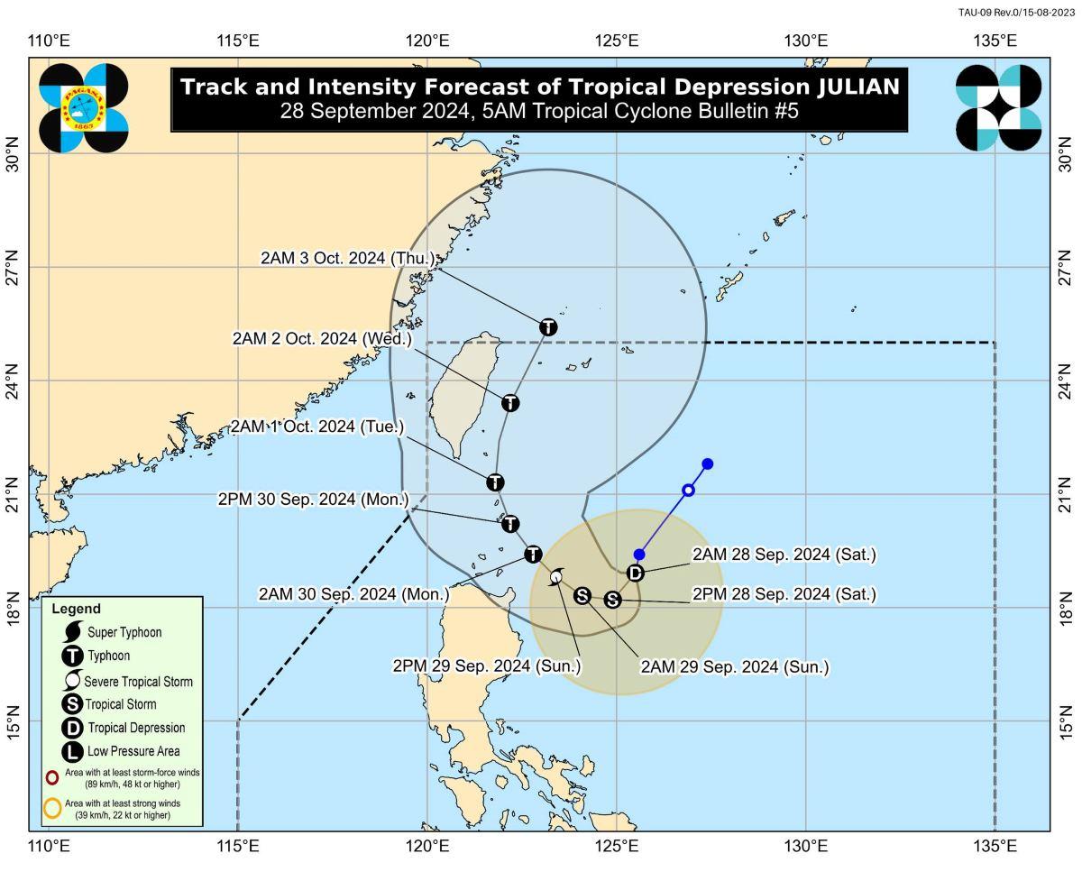
Meanwhile, Julian has maintained its strength as it barrelled southward over the Philippine Sea.
It was noted that the center of the eye of Julian was said to be at 400 kilometers east of Aparri, Cagayan packing maximum sustained winds of 55 kilometers per hour near the center and with gustiness of up to 70 kph.
It is moving southward at 10 kph.
Strong winds extending outwards up to 360 km was known from its center.
“Julian is forecast to follow a looping path over the waters east of Batanes and Cagayan in the next five days,” PAGASA said.
It may make landfall over Batanes by Monday afternoon or evening as a typhoon then exit the Philippine Area of Responsibility by Wednesday (2 October) evening to Thursday (3 October) early morning.
Severe winds
The strong winds with speeds of 39 to 61 km/h in these areas will pose minimal to minor threat to life and property.
PAGASA said the wind flow coming towards the circulation of Julian may also bring strong to gale-force gusts over the following areas, especially in coastal and upland areas exposed to winds, on Saturday: Aurora, Quezon, Camarines Norte, Camarines Sur, and Catanduanes.
How useful was this post?
Click on a star to rate it!
Average rating 0 / 5. Vote count: 0
No votes so far! Be the first to rate this post.
We are sorry that this post was not useful for you!
Let us improve this post!
Tell us how we can improve this post?