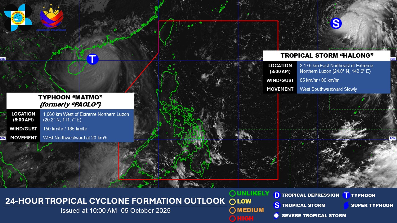

WHILE Severe Tropical Storm Paolo had exited the Philippine Area of Responsibility, a new low pressure area is being monitored by state weather forecasters which may develop into a new tropical depression.
According to the Philippine Atmospheric, Geophysical and Astronomical Services Administration or PAGASA, it is expected to enter PAR next week.
It was recorded at 2,275 km east northeast of Extreme Northern Luzon.
Presently it has not affected any part of the country
According to the Japan Meteorological Agency, the initial forecast track for the disturbance revealed that it would enter the Philippine area of responsibility by Tuesday and could turn into a severe tropical storm before heading towards the Ryukyu Islands.
Once it enters PAR it will be named Quedan.
Read More:
- PAGASA: Tropical depression weakens to LPA
- No weather disturbance, Fri-yey!
- SONA SPECIAL REPORT: Police prepare for protests as activists take to the streets
- 0-1 tropical cyclone may enter PAR in February – PAGASA
- PAGASA: LPA to develop into tropical depression Aghon by Friday
How useful was this post?
Click on a star to rate it!
Average rating 0 / 5. Vote count: 0
No votes so far! Be the first to rate this post.
We are sorry that this post was not useful for you!
Let us improve this post!
Tell us how we can improve this post?