
STATE weather forecasters said that Tropical Storm Marce (international name Yinxing) has intensified as it traversed the Philippine waters.
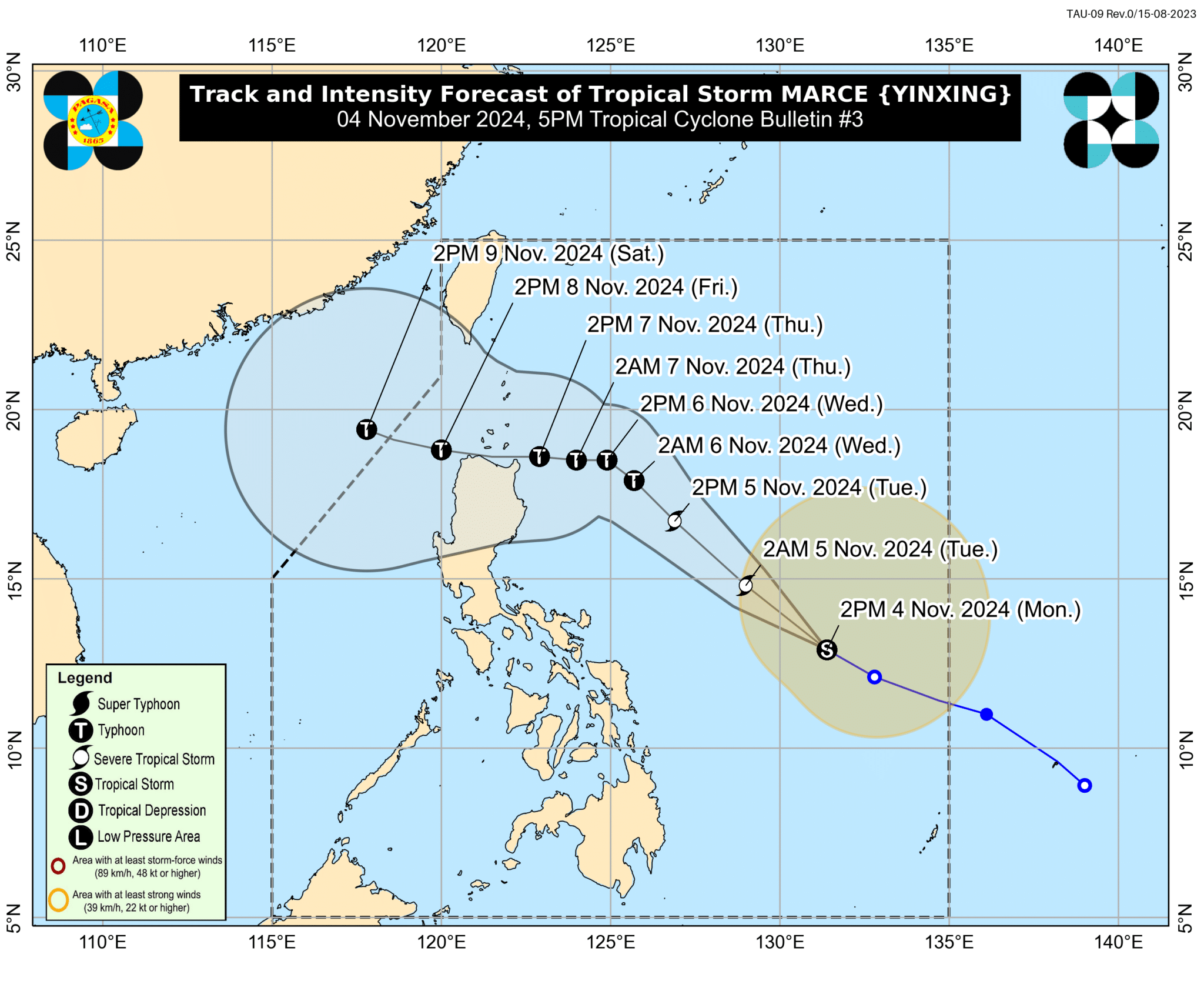
PAGASA said that ‘Marce’ is packing maximum sustained winds of 85 kph near the center and gustiness of up to 105 kph.
The weather bureau also said in their 5 p.m. bulletin on Monday that they might hoist Tropical Cyclone Wind Signal No. 1 over portions of Cagayan either tonight or until Tuesday.
“Marce has no direct effect on any part of the country yet. However, its trough will bring cloudy skies, scattered rains and thunderstorms across mainland Cagayan, Isabela and Bicol Region,” PAGASA forecaster Veronica Torres said in a briefing.
Torres added that those areas could experience floods and landslides during moderate to heavy rains.
Meanwhile, PAGASA said Metro Manila and the rest of the country will have better weather, with isolated rain showers due to localized thunderstorms.
Marce was located 740 kilometers east of Virac, Catanduanes as of 4 p.m.
It is forecast to make landfall over the vicinity of Babuyan Islands or mainland northern Cagayan on Thursday evening or Friday.
The said weather disturbance is expected to enhance the northeasterly wind flow this week.
Marce’s trough will bring rains over extreme Northern Luzon and the eastern section of Luzon beginning Tuesday.
How useful was this post?
Click on a star to rate it!
Average rating 0 / 5. Vote count: 0
No votes so far! Be the first to rate this post.
We are sorry that this post was not useful for you!
Let us improve this post!
Tell us how we can improve this post?