ON WEDNESDAY, July 24, the intensification of Super Typhoon Carina on the Southwest Monsoon or “Habagat” caused uninterrupted heavy rains and major floods in Metro Manila, the worst in recent years.

Photo Courtesy: Manila DRRM Office | Facebook
According to PAGASA rainfall data, the typhoon deposited more rain in Quezon City than Typhoon Ondoy did in September 2009, when the capital region was severely devastated.
Typhoon Ondoy comparisons
From 2:00 a.m. Wednesday to 2:00 a.m. Thursday, a whopping 461.4 millimeters of rain were recorded in Science Garden station, which is equivalent to one month’s worth of rain in the area.
Meanwhile, Typhoon Ondoy’s 24-hour rainfall total stands at 455mm, with 341.3mm falling in just six hours.
However, the World Meteorological Organization specified that normal 24-hour weather data must be measured from 8:00 a.m. today to 8:00 a.m. the next day.
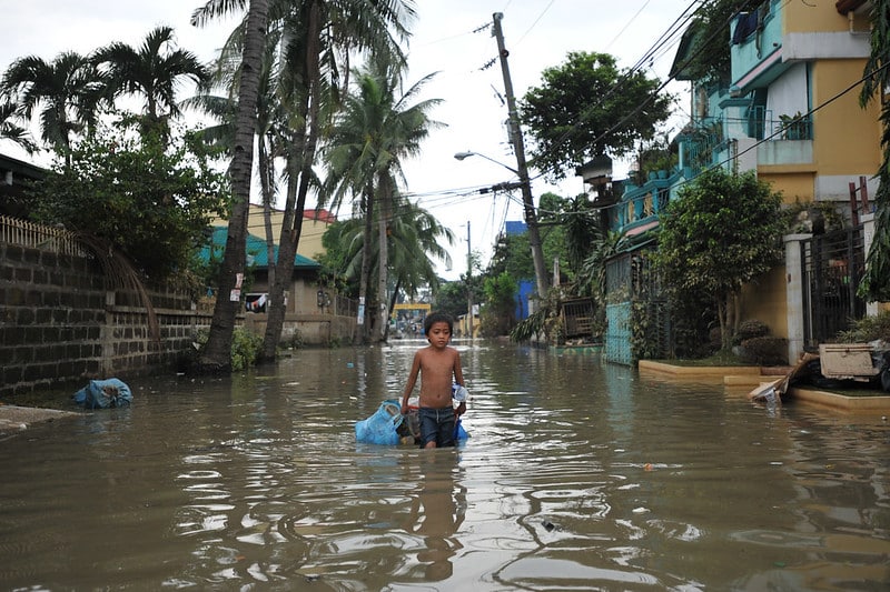
Photo Courtesy: flickr
Nonetheless, the widespread flood, constant rain, and gusting wind prompted the Metro Manila Council to proclaim a state of calamity for the whole region.
Many local government units (LGUs) in Metro Manila and surrounding Luzon provinces mobilized rescue teams as thousands struggled with the effects of the southwest monsoon.
Latest weather bulletin
Typhoon Carina is now less likely to provide significant rainfall to any part of the country, according to PAGASA-DOST’s 11:00 a.m. tropical cyclone bulletin.
However, the habagat strengthened by the typhoon will continue to produce heavy to intense rains to the Ilocos Region, Zambales, and Benguet today.
From today to Saturday, moderate to severe rainfall is forecast in various locations across western Luzon.
Despite Typhoon Carina being outside of the Philippine Area of Responsibility (PAR), the province of Batanes remains under Tropical Wind Cyclone Signal No. 1.
Earlier this morning, PAGASA notified Metro Manila and surrounding areas that light to moderate rainfall will persist throughout the day.
“Dito sa Metro Manila possible na ngayon araw hanggang bukas, posible hanggang Friday, may mga pag-ulan pa rin tayo. Posible lang mabawasan yung pag ulan beginning Saturday pa po,” said PAGASA Assistant Weather Services chief Chris Perez.
The typhoon continues to march northwest and is likely to make its final landfall in southeastern China this afternoon or tonight. Carina has also weakened as it faces steep terrain in Taiwan.