THE low pressure area located east of Mindanao has developed into Tropical Depression Kabayan, with heavy rains expected in several provinces in the next two days.
Tropical Cyclone Wind Signal No. 1 was raised over the following areas:
- the southern portion of Samar (Basey, Santa Rita, Marabut);
- the southern portion of Eastern Samar (Maydolong, City of Borongan, Quinapondan, Guiuan, Lawaan, Balangiga, Llorente, Giporlos, Salcedo, Balangkayan, General Macarthur, Hernani, Mercedes);
- the eastern and southern portions of Leyte (Mahaplag, Abuyog, Javier, Macarthur, Tabontabon, La Paz, Mayorga, Tolosa, Tanauan, Julita, Dulag, Palo, Tacloban City, Babatngon, Matalom, Hilongos, Bato);
- Southern Leyte;
- Dinagat Islands;
- Surigao del Norte;
- Surigao del Sur;
- Agusan del Norte;
- the northern and eastern portions of Agusan del Sur (Bunawan, San Francisco, City of Bayugan, Esperanza, Talacogon, Rosario, Sibagat, Prosperidad, San Luis, Trento);
- the northern portion of Davao Oriental (Boston, Cateel);
- the eastern portion of Misamis Oriental (Gingoog City, Magsaysay, Medina, Talisayan, Balingoan, Kinoguitan); and
- Camiguin.
Surigao del Sur will see 100 to 200 millimeters of rain, while Dinagat Islands, Surigao del Norte, Agusan del Norte, the eastern portion of Agusan del Sur, and the northern portions of Davao Oriental and Davao de Oro will experience 50 to 100 mm of rain on Sunday.
On Monday, the forecast accumulated rainfall was as follows:
Surigao del Sur, Surigao del Norte, Dinagat Islands, and Southern Leyte – 100 to 200 mm
The southern portions of Eastern Samar and Samar, the eastern and southern portions of Leyte, Bohol, Cebu, Negros Oriental, Siquijor, Camiguin, Misamis Oriental, the northern portion of Bukidnon, Agusan del Sur, and Agusan del Norte – 50 to 100 mm
”Forecast rainfall is generally higher in elevated or mountainous areas. Under these conditions, flooding and rain-induced landslides are likely especially in areas that are highly or very highly susceptible to these hazards as identified in hazard maps and in localities that experienced considerable amounts of rainfall for the past several days,” PAGASA said.
”In addition, the shear line coinciding with the passage of Kabayan may bring heavy rainfall over the eastern portion of Southern Luzon today and over the eastern portion of Luzon tomorrow.”
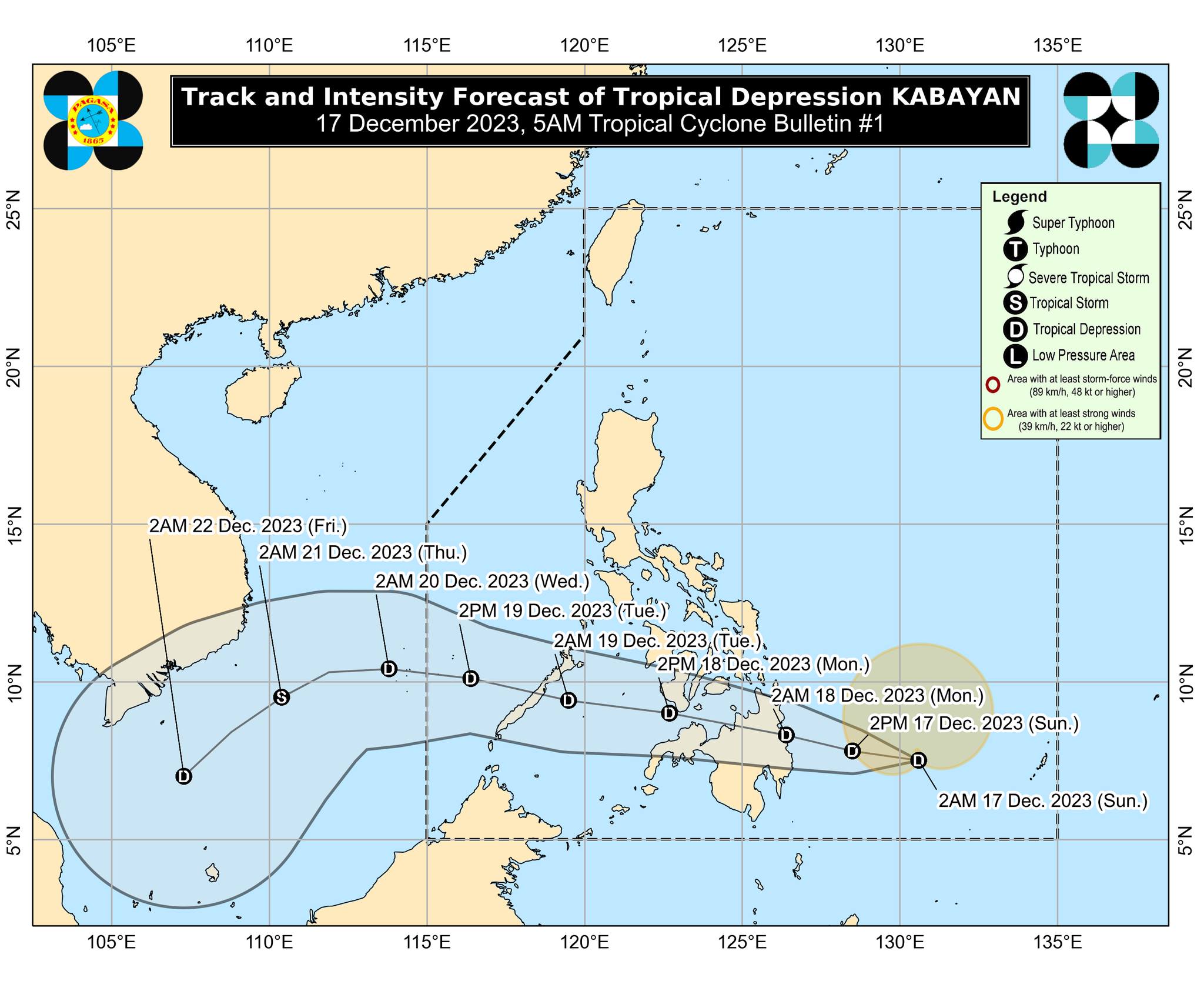
At 4 a.m., Kabayan was spotted 460 kilometers east southeast of Hinatuan, Surigao del Sur, carrying maximum sustained winds of 55 kilometers per hour near the center and gustiness of up to 70 km/h. It was moving westward at 10 km/h.
Kabayan is expected to make landfall along the coast of Surigao del Sur or Davao Oriental on Sunday night or early Monday morning. It will then cross Mindanao’s rugged terrain before emerging over either the Bohol Sea or Sulu on Monday afternoon.
”Due to frictional effects associated with landall, Kabayan is forecast to weaken over land, and the possibility of being downgraded into a low pressure area while over land or after emerging over the sea is not ruled out (although in such a case, re-development may occur over the Sulu Sea),” PAGASA said.