Typhoon Goring maintained its strength as it continued to affect Northern Luzon, according to PAGASA on Tuesday morning.
Signal No. 3 was hoisted over the northeastern portion of the Babuyan Islands, while Batanes, the rest of the Babuyan Islands, and the extreme northeastern portion of mainland Cagayan (Santa Ana, Gonzaga) were under Signal No. 2 as of 5 a.m.
Signal No. 1 was raised over the following areas:
- the northern and eastern portions of mainland Cagayan (Camalaniugan, Pamplona, Santa Teresita, Baggao, Buguey, Claveria, Aparri, Ballesteros, Abulug, Sanchez-Mira, Santa Praxedes, Allacapan, Lal-Lo, Lasam, Peñablanca, Iguig, Amulung, Gattaran, Alcala, Santo Niño)
- the eastern portion of Isabela (Dinapigue, San Mariano, Ilagan City, Tumauini, San Pablo, Cabagan, Maconacon, Divilacan, Palanan), the northern portion of Apayao (Flora, Calanasan, Luna, Pudtol, Santa Marcela)
- the northern portion of Ilocos Norte (Vintar, Pasuquin, Burgos, Dumalneg, Adams, Pagudpud, Bangui)
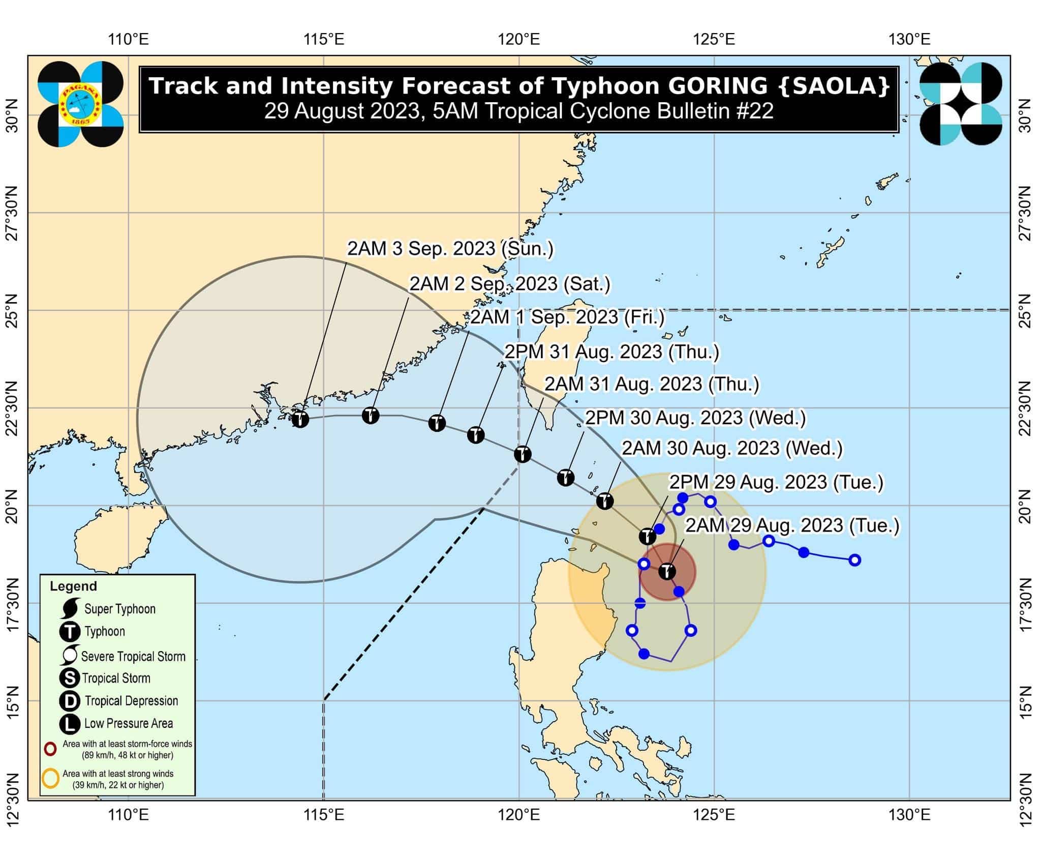
At 4 a.m., Goring was located 220 kilometers east of Aparri, Cagayan, packing maximum sustained winds of 155 kilometers per hour near the center and gustiness of up to 190 km/h.
Moving north northwestward at 10 km/h, Goring will continue to enhance the Southwest Monsoon (Habagat), with occasional or monsoon rains expected in the western portions of Central Luzon, Southern Luzon, and Visayas over the next three days.
A gale warning is in effect for the northern and eastern seaboards of Northern Luzon, the eastern and western seaboards of Central Luzon, the seaboards of Southern Luzon, seaboards of Visayas, and the northern seaboard of Mindanao.
“Disruption in civilian maritime activities is expected over these areas (e.g., suspension of sea travel) due to hazardous sea condition,” the state weather bureau said.
PAGASA said Goring is forecast to follow a mainly northwestward or west northwestward path across the Luzon Strait from Tuesday until it exits the Philippine Area of Responsibility (PAR) on Wednesday evening or Thursday morning.
“The latest track forecast indicates that the typhoon may pass very close or make landfall in the vicinity of Batanes between tomorrow morning and afternoon (although a slight southward shift in the track forecast may bring the eye and eyewall region of the typhoon to the northern portion of Babuyan Islands),” it said.
“During this period, the typhoon is forecast to re-intensify and may peak at near-super typhoon strength by the time it passes very close or over Batanes (although re-intensifying into a super typhoon is not ruled out).”
A total of 7,919 people, or 2,302 families, in the Ilocos Region, Cagayan Valley, Calabarzon, Mimaropa, Western Visayas, and the Cordillera Administrative Region (CAR) have been affected by the typhoon, government data showed.
There are no reports of casualties, injured persons, or missing persons.