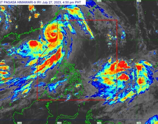
State weather forecasters are monitoring a new tropical cyclone as Typhoon Egay now heads to China after pounding northern Luzon with heavy rain and strong winds.
At 3 p.m., the tropical depression was located 1,560 kilometers east of Eastern Visayas, with maximum sustained winds of 55 kilometers per hour and gustiness of up to 70 km/h, PAGASA said in its 4 p.m. daily weather bulletin.
It was moving west northwest at 20 km/h.
Meanwhile, the following areas remained under Signal No. 1, though Egay was already outside the Philippine Area of Responsibility:
- Batanes
- northern portion of Apayao (Calanasan, Luna, Santa Marcela)
- Ilocos Norte
- northwestern portion of Cagayan (Santa Praxedes, Claveria, Sanchez-Mira, Pamplona, Abulug, Ballesteros) including Babuyan Islands
Egay’s center was spotted 280 km west northwest of Itbayat, Batanes at 4 p.m. The typhoon carried maximum sustained winds of 150 km/h near the center and gustiness of up to 185 km/h.
Egay is expected to make landfall in the vicinity of Fujian, China, on Friday morning.
”The Southwest Monsoon enhanced by Egay will continue to bring occasional to monsoon rains over the western portions of Northern and Central Luzon and Southern Luzon in the next three days,” PAGASA said.
At least five people reportedly died amid Egay’s onslaught, which will be validated by the National Disaster Risk Reduction and Management Council.


