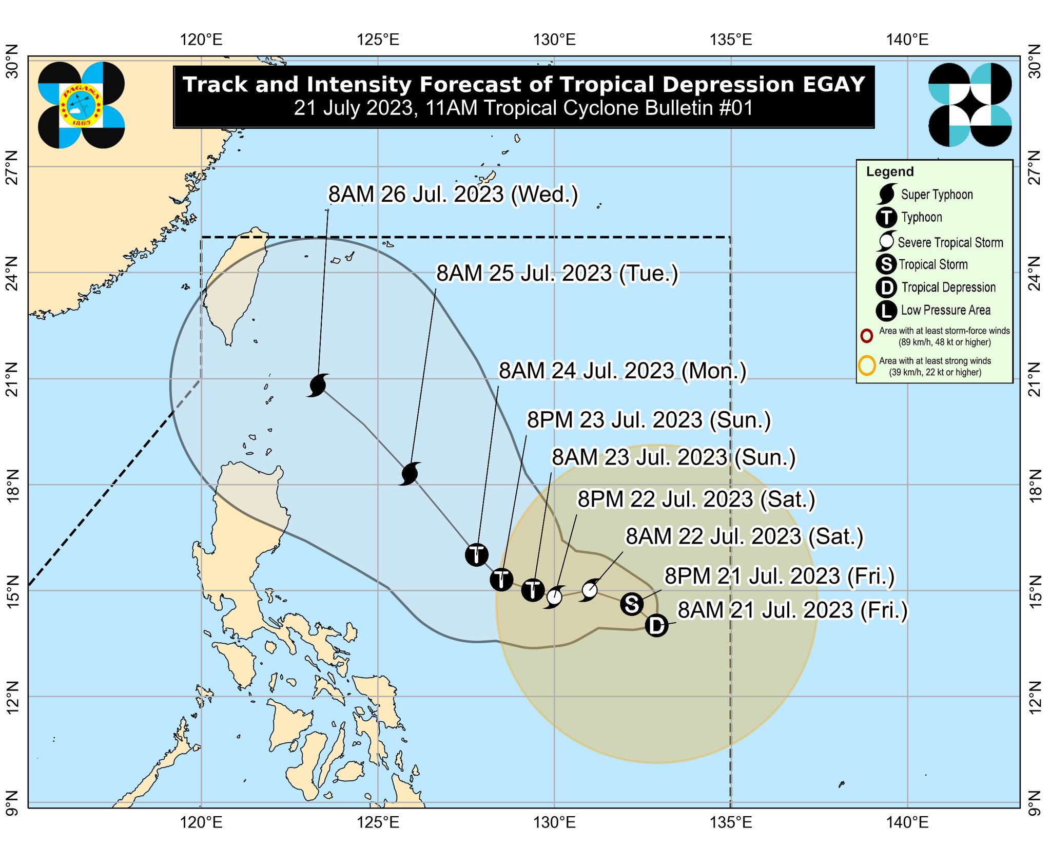
State weather forecasters are keeping an eye on Tropical Depression Egay, which has the potential to intensify into a super typhoon early next week and might make landfall in northern Luzon.
The weather bureau PAGASA said on Friday that Egay is forecast to move slowly in the next 24 hours and will track generally west-northwestward until late Sunday before turning northwestward over the Philippine Sea.
”While the current track forecast shows that Egay will remain offshore over the waters east of Luzon, the forecast confidence cone shows that a landfall scenario over the eastern portion of mainland Cagayan and Batanes is not ruled out,” it said.
Egay is expected to intensify into a tropical storm in the next 12 hours, and reach the super typhoon category by late Monday or early Tuesday as it moves over the Philippine Sea, PAGASA added.
As of 10 a.m., the center of Egay was located 900 kilometers east of southeastern Luzon. It has maximum sustained winds of 55 km/h near the center and gustiness of up to 70 km/h, moving slowly north-northwestward.
”In areas that will not be directly affected by Egay, monsoon rains from the enhanced Southwest Monsoon are possible over the western sections of MIMAROPA and Visayas on Sunday. On Monday and Tuesday, monsoon rains are likely over the western sections of Southern Luzon and Western Visayas,” PAGASA said.
”Under these conditions, flooding and rain-induced landslides are possible, especially in areas that are highly or very highly susceptible to these [hazards] as identified in hazard maps and in localities [that have] experienced considerable amounts of rainfall for the past several days.”