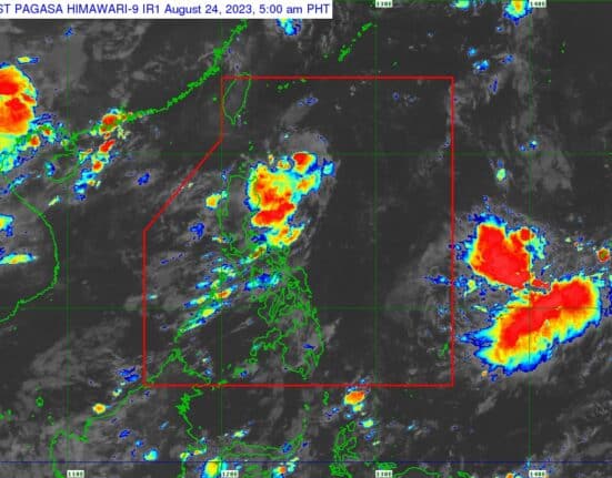
The low pressure area over the Philippine Sea has developed into Tropical Depression Goring, according to PAGASA early Thursday morning.
In its 5 a.m. bulletin, PAGASA said Goring was spotted 400 kilometers east northeast of Aparri, Cagayan, or 405 km east of Calayan, Cagayan, at 4 a.m.
Goring was packing maximum sustained winds of 55 kilometers per hour near the center and gustiness of up to 70 km/h, moving west northwestward slowly.
PAGASA said the hoisting of storm signals over areas in Northern Luzon may begin on Thursday night or Friday.
”However, the hoisting may happen earlier should there be changes in the forecast scenario,” the state weather bureau said.
Goring may also enhance the Southwest Monsoon starting on Sunday or Monday, ”resulting in possible occasional rains over the western portions of Central and Southern Luzon,” PAGASA said.
”The possible enhancement of the Southwest Monsoon may result in gusty conditions beginning on Sunday or Monday over most of Southern Luzon and Visayas, as well as portions of Caraga. The gusty conditions are more likely in coastal and upland/mountainous areas exposed to winds,” it added.
Goring is expected to move northwestward in the next 12 hours, then turn southward while over the waters off the eastern coast of the Cagayan Valley.
In the next five days, Goring will follow a generally looping track and may likely return to a more northward movement by late Monday or Tuesday.
”Goring is forecast to steadily intensify throughout the forecast period and may reach the tropical storm category tonight or tomorrow morning. It may be upgraded into a typhoon category by Sunday during the southward segment of its looping track,” PAGASA said.


