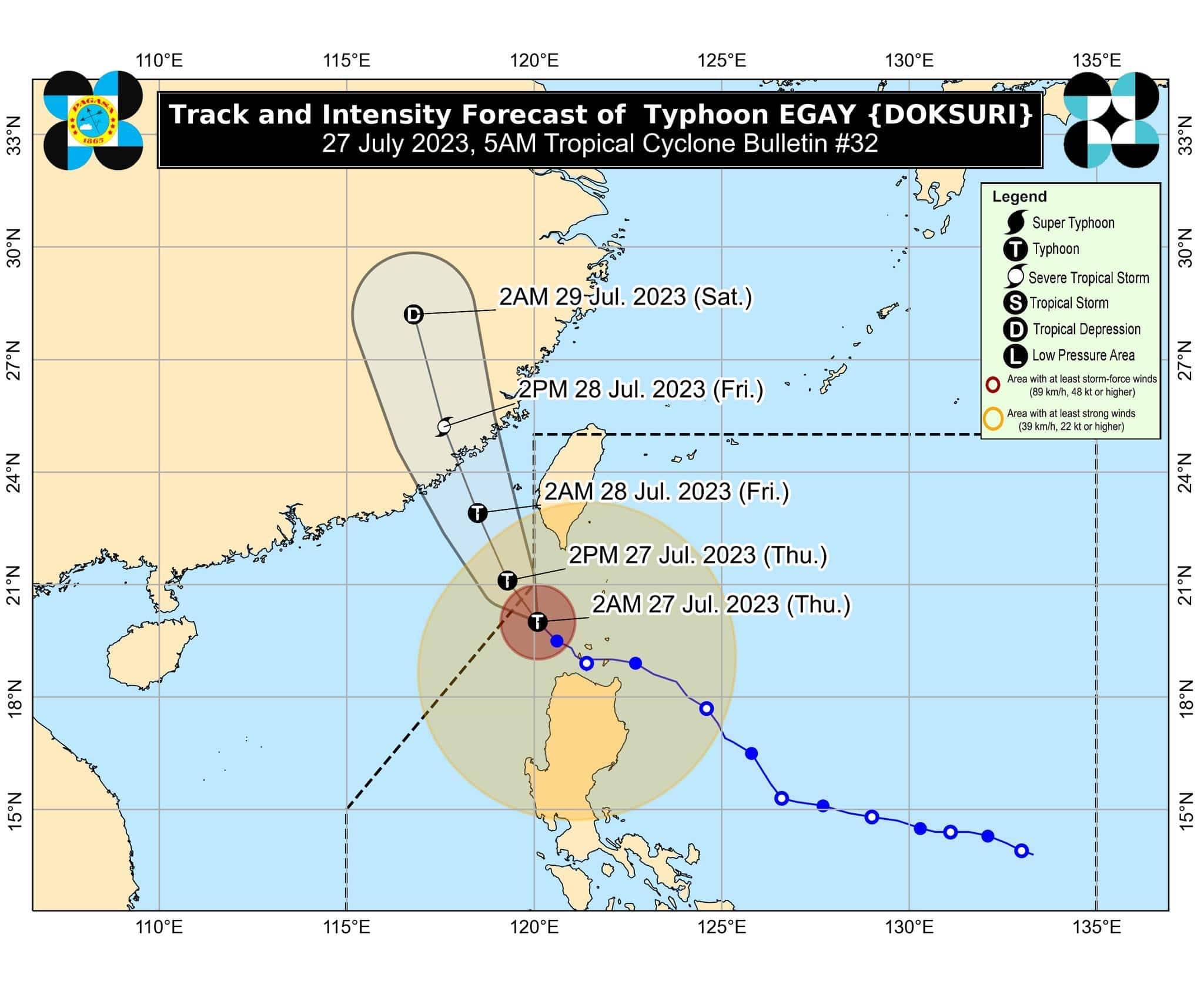
Typhoon Egay has weakened ahead of its exit from the Philippine Area of Responsibility (PAR) later Thursday, the state weather bureau PAGASA said in its 5 a.m. bulletin.
At 4 a.m., the center of Egay was located 195 kilometers west of Basco, Batanes, carrying maximum sustained winds of 150 km/h near the center and gustiness of up to 185 km/h.
It was moving northwestward at 15 km/h.
Signal No. 2 was raised over the following areas:
-Batanes, Cagayan including Babuyan Islands, Apayao, Kalinga, Abra, Ilocos Norte, and the northern and central portion of Ilocos Sur (Magsingal, San Esteban, Banayoyo, Burgos, City of Candon, Santiago, San Vicente, Santa Catalina, Lidlidda, Nagbukel, Sinait, San Ildefonso, Galimuyod, City of Vigan, San Emilio, Cabugao, Caoayan, San Juan, Santa, Bantay, Santo Domingo, Santa Maria, Narvacan)
Areas under Signal No. 1 are as follows:
-Isabela, Quirino, Nueva Vizcaya, Mountain Province, Ifugao, Benguet, the rest of Ilocos Sur, La Union, Pangasinan, Aurora, Nueva Ecija, Tarlac, and the northern portion of Zambales (Botolan, Iba, Candelaria, Cabangan, Palauig, Santa Cruz, Masinloc)
PAGASA said the Southwest Monsoon enhanced by Egay would continue to bring occasional to monsoon rains over the western portions of Central Luzon and Southern Luzon in the next three days.
“There is a moderate to high risk of storm surge which may cause flooding in the low-lying and exposed coastal areas of Batanes, the northwestern portion of Cagayan including Babuyan Islands, Ilocos Norte, and extreme northern portion of Ilocos Sur. Maximum surge heights may reach 3.0 m some of the warning areas,” it added.
Egay is expected to leave the PAR on Thursday morning or afternoon and make landfall in the vicinity of Fujian, China, on Friday morning.