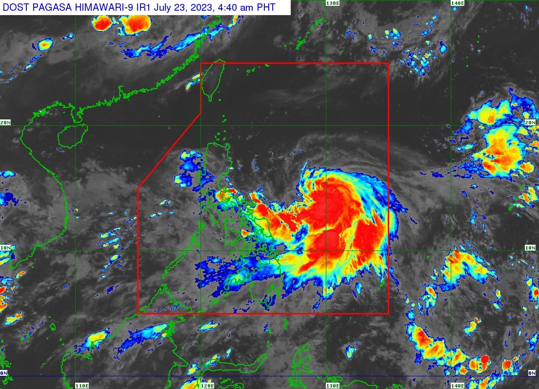
Tropical Storm Egay has gained strength as it moved west-northwestward off the coast of the Bicol Region, the state weather bureau PAGASA said early Sunday morning.
As of 4 a.m., Egay was spotted 585 kilometers east northeast of Virac, Catanduanes, or 705 km east of Daet, Camarines Norte. It was moving west-northwestward at 10 km/h, carrying maximum sustained winds of 85 kph near the center with gustiness of up to 105 kph.
Egay is expected to develop into a severe tropical storm, meaning its maximum sustained winds will be at least 87 km/h.
”In anticipation of the arrival of strong breeze to near-gale conditions directly caused by Egay, Wind Signals may be hoisted in some areas in Bicol Region and Eastern Visayas today,” PAGASA said in an update issued at 5 a.m.
”Current forecast scenario shows that the highest wind signal that may be hoisted will be Wind Signal No. 3 or 4, potentially over Extreme Northern Luzon. However, should a southward shift in the track occur, higher wind signals may be hoisted.”
The tropical cyclone and the enhanced Southwest Monsoon will bring gusty conditions over the following areas, especially in coastal and upland/mountainous areas exposed to winds:
- Sunday: MIMAROPA, Visayas, and the northern portions of the Zamboanga Peninsula, Northern Mindanao, and Caraga.
- Monday: CALABARZON, MIMAROPA, Visayas, Zamboanga Peninsula, and the northern portions of Northern Mindanao and Caraga.
- Tuesday: Most of Luzon and Visayas and the northern portions of the Zamboanga Peninsula, Northern Mindanao, and Caraga.
Egay is forecast to reach typhoon status within 24 hours and may become a super typhoon on Tuesday.
It will be closest to extreme northern Luzon on Wednesday.
”Based on the current and forecast behavior of the ridge of high pressure to the north of Egay, a ‘westward shift’ in the track forecast remains a possibility,” the agency said.
”A slight weakening trend may begin on Wednesday and will continue until Egay makes landfall over Taiwan. Interaction with the mountainous terrain of Taiwan will result in further weakening, a trend that will continue until the tropical cyclone makes another landfall on mainland China.”


