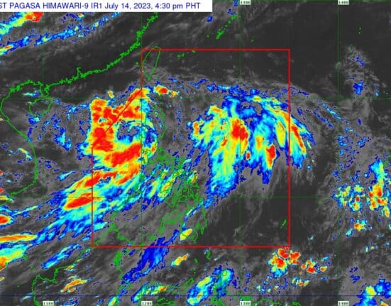
Tropical Depression Dodong will continue to bring heavy rains to several provinces in northern Luzon, the state weather bureau PAGASA said on Friday afternoon.
In its 5 p.m. update, PAGASA said Signal Number 1 was hoisted over the following areas:
- Cagayan including Babuyan Islands
- Apayao
- Ilocos Norte
- Abra
- Ilocos Sur
- Mountain Province
- Kalinga
- northern portion of Isabela (Mallig, Quezon, Santa Maria, Cabagan, Delfin Albano, Tumauini, Santo Tomas, San Pablo, Maconacon)
Meanwhile, the enhanced southwest monsoon (Habagat) will affect MIMAROPA, the Bicol Region, Western Visayas, CALABARZON, Zambales, Bataan, Aurora, Pangasinan, La Union, Isabela, and Benguet on Saturday, and MIMAROPA, the Bicol Region, Western Visayas, Cavite, Zambales, Bataan, Aurora, Pangasinan, La Union, Isabela, and Benguet on Sunday
At 4 p.m., Dodong’s center was located over the coastal waters of Laoag, Ilocos Norte, with maximum sustained winds of 45 kilometers per hour near the center and gustiness of up to 75 km/h. It was moving westward at 20 km/h.
Dodong is expected to move westward or west-northwestward before turning generally northwestward over the West Philippine Sea until it exits the Philippine Area of Responsibility (PAR) on Saturday evening or early Sunday morning.
”Outside the PAR, Dodong will move generally west-northwestward over the waters south of southern China. Dodong may reach the tropical storm category by tomorrow while over the West Philippine Sea,” PAGASA said.


